|
|
|
|
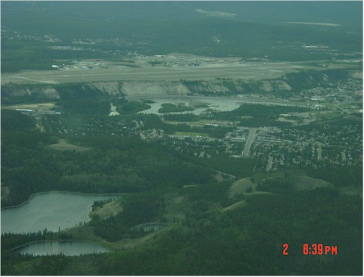
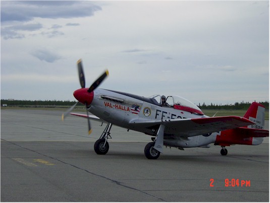
David writes... Finally, the weather clears. We left Dawson Creek around 10 am and made our way to Ft. Nelson. Our friends Dave and Judy joined us on our frequency and we all headed north. Earl, Jim and I filed direct as the Alaska Highway goes quite far west, then back to the east to Ft. Nelson. Dave and Judy followed the Highway. As I crossed Fort St. John, the controller advised that another pilot went direct and ran into low ceilings. I amended and followed the Highway relaying the message to Jim and Earl. They decided to go direct. It worked out well for them although they did need to dodge a couple rain showers. We landed into Ft. Nelson, fueled up and took off as quickly as possible as the weather briefer said Cumulous clouds were going to be building throughout the afternoon on our way to Watson Lake. Earl, Jim and I again filed direct, although I told the briefer I was going to cut over to the Highway at Liard Springs (the highway is close to direct at that point). Dave and Judy filed for the Highway all the way. I left right behid Dave and Judy. About 30 minutes out, they called and said they had to turn around due to low ceilings and rain in the pass. Looking in the distance, I saw about 6 rain cells in front of me, but plenty of sunshine in between them...at least for now. I wasn't able to cut south to the highway exactly where I wanted to due to a rain shower, but did so just a few miles later. Over the road where I was, there were clear skies and smooth sailing. Dave and Judy decided to go back to Ft. Nelson and wait it out. Earl and Jim were about 30 miles behind me and the picture of the rain storms had changed by the time they got to them. The upshot was that my directions were practically useless to them. They plotted a course north weaving through the rain cells and came into Watson Lake about 25 miles north of course...still beating me there by about 15 minutes (this is becoming a standard joke...I leave 30 minutes before Jim and Earl and they arrive 30 minutes before I do, passing me up somewhere in the middle. What really hurts is that they usually take some side trip to boot! My only come back is telling them about how little fuel I need when I get to the pumps and that I get to log more pilot time!) Another quick turn around at Watson Lake and we are off for Whitehorse. During this leg, we saw some of the most beautiful mountains we have seen to date. At one point, looking south, the jagged, snow-capped peaks stretched as far as we could see. The lakes are plentiful and huge in this part of the country. Our path brought us to Teslin Lake about midpoint down the lake. I flew for nearly 30 minutes before I got to the end of it! We set down in Whitehorse late in the day, after about 8 hours of flying. Whitehorse is an interesting approach. The runway sits on a table about 100 to 150 feet above the city. You come in over the city and land above it...just different. As we were tying our planes down, a beautiful P-51 Mustang landed. The plane was named Val-Halla and in reading the side of the plane, it had seen service during WWII and raced in the Reno Air Races. It was a beautiful plane and hearing that Rolls Royce Merlin engine banging as she taxied up near our planes...well, it is a unique sound. As we are truly in the north country in summer, the sun goes down, but there is light most of the night. Jim is a big fan of Robert Service's poem "The Cremation of Sam McGee." That takes place at Lake Leberge, which is just north of town. So, we hopped in our car and took a trip to Lake Leberge.
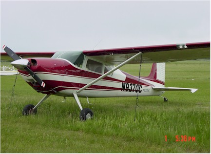
Dave and Judy's pretty Cessna 180 tied down at Dawson Creek
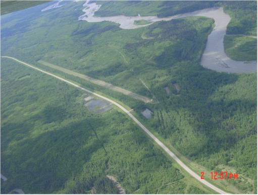
The Alaska Highway north of Fort St. John. Notice the grass runway next to the Highway. Abandoned now, but one of many that was used to ferry aircraft during WWII.
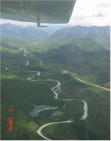
Joining back up with the Highway east of Liard Hot Springs between Ft. Nelson and Watson Lake. Earl and Jim are dodging rain cells somewhere 30 miles north.
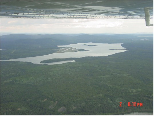
Leaving Watson Lake in the Yukon. You can see the airstrip mid-lake.
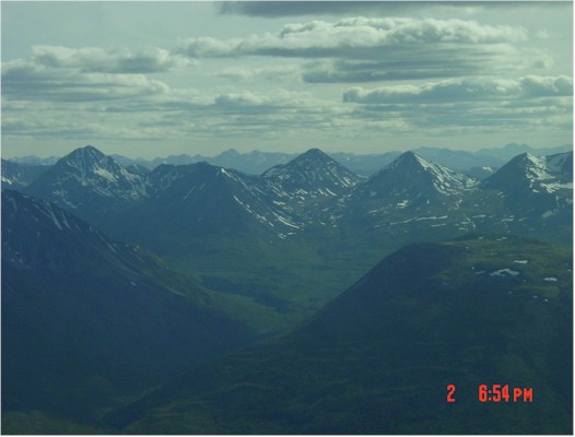
Mountains between Watson Lake and Whitehorse. Picture doesn't do it justice...as far as the eye could see, these jagged peaks met the horizon.
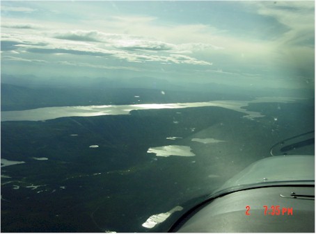
Teslin Lake stretches for miles.
Whitehorse, Yukon Territories. City down below, the airfield up on the table above.
Val-Halla, a beautiful P-51 Mustang that came from Anchorage landed just after we did. |
|
|